Places To Visit
Banba’s Crown
Banba is a mythical patron goddess, and an ancient, poetic name for Ireland. Describing it’s most northerly point as her ‘crown’ therefore is likely a case of symbolic or romantic extraction. The iconic landmark of the area is the signal tower. It was constructed in 1805 by Lloyd’s during the Napoleonic Wars. Its original purpose was to act as a coastguard, reporting via semaphore on ships passing along this busy transatlantic route.
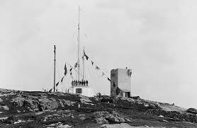
In 1902 the Marconi Company sent the first commercial message by wireless from Malin Head to the passenger ship S.S. Lake Ontario making Malin Head the earliest (and hence longest operating) Coastguard Radio Station in the world. A date of note is April 2nd 1912, when the station received a greetings message, on behalf of the newly constructed Titanic. The Coastguard Station is now located adjacent to the Crossroads Inn.
Hell’s Hole (Coastal Walk)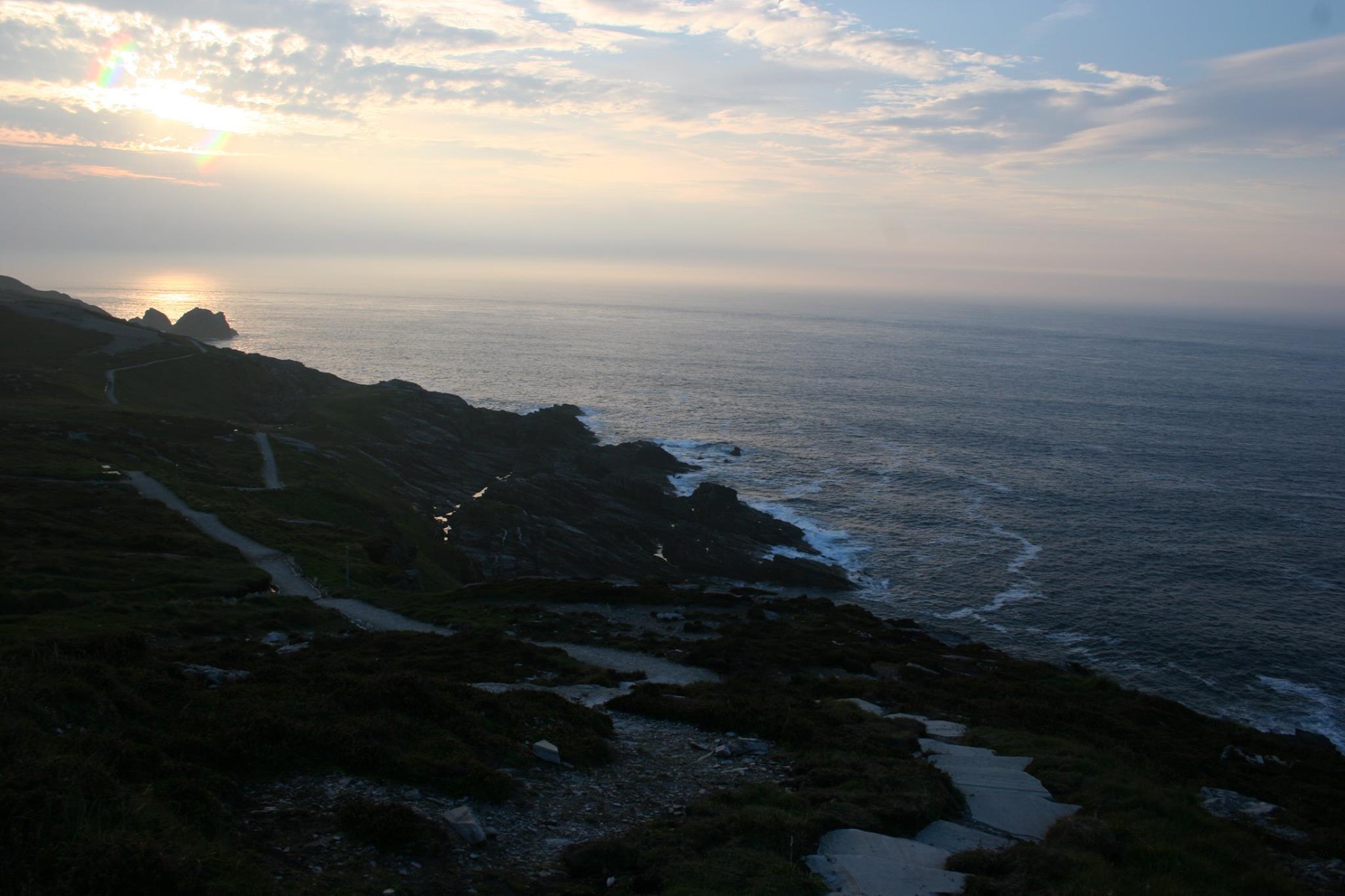
Following the 750m coastal path west from Banba’s Crown you come to a natural feature known locally as Hell’s Hole. Hell’s Hole is a deep chasm in the cliff face, about 250 feet long, 8 feet wide, and 100 feet deep. The water rushes into the narrow neck making a thunderous sound as it enters the cavern at the end of the gorge.
Scheildren
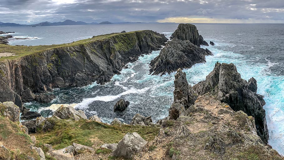
The view over Scheildren may be the most photographed in Malin Head. The name comes from the Icelandic word ‘Skjöldur’ meaning a Shield. There is no land between here and either Iceland, Greenland or Newfoundland. The view over Scheildren can be accessed today by walking along the coastline west beyond the existing path. Particular care should be taken at all times as the route is ill-defined over heather, rock and shale.
Ballyhillin Raised Beach
Below Banba’s Crown to the east lies Ballyhillin Beach, known locally as ‘Kitter’s’ (derived from ‘Ciotóg’, the irish word for left handed). This raised beach of scientific importance is where gemstones such as opal, jasper, amethyst and topaz are most likely to be found.
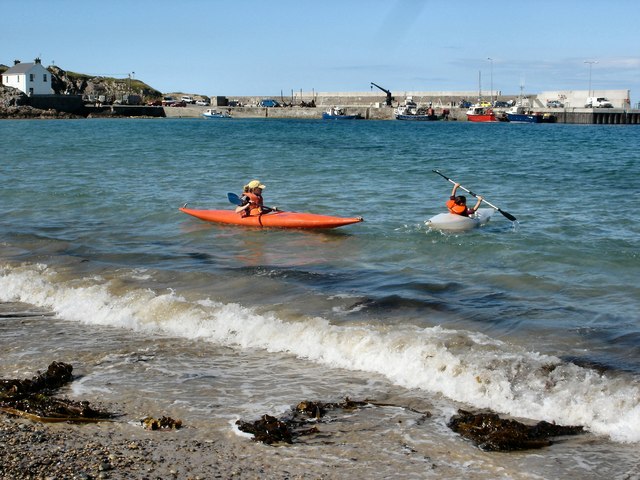
Family Beaches
There are a number of local beaches which are particularly popular with families and those looking to take to the water for sport or to wet their feet. These include the beach at the foot of the Pier, Portmor (below Farren’s Bar) and Sandport (accessed from the Rodden path between Farren’s Bar and the Seaview Stores).
Malin Well
This site of pilgrimage and intrigue lies one mile east of Portmor Pier. The prominent feature here is the ruin of St. Mahar’s (Gorman’s), a simple, late medieval church. 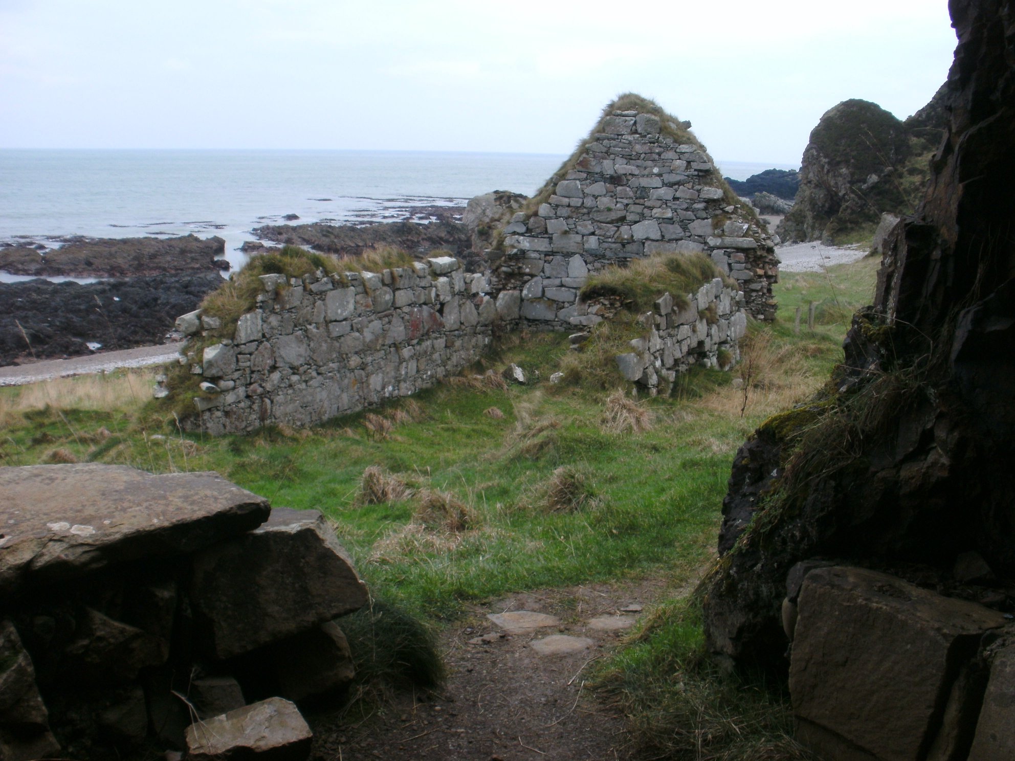
South west of the church is a small cave carved into a cliff face known as ‘The Wee House of Malin’. There are rough stone seats all around the interior and legend claims it accommodates all who go into it (though visitors are advised to keep a safe distance as some rockfalls and collapses have been reported in recent times). 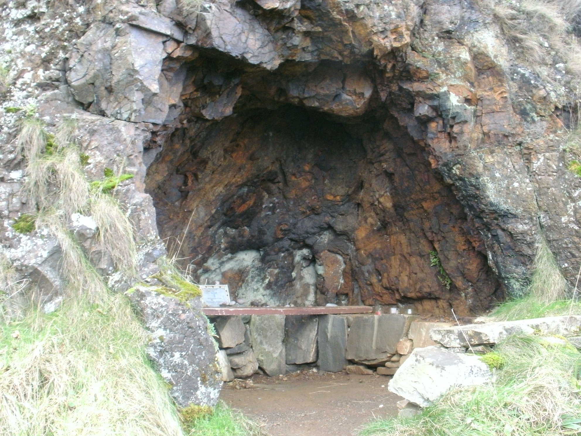
The well itself is located on the shoreline to the right. The well is supplied by a spring and is covered by high tide. On the shore directly below the church there is a fabled ‘wishing seat’ located within a natural cavern in the rock.
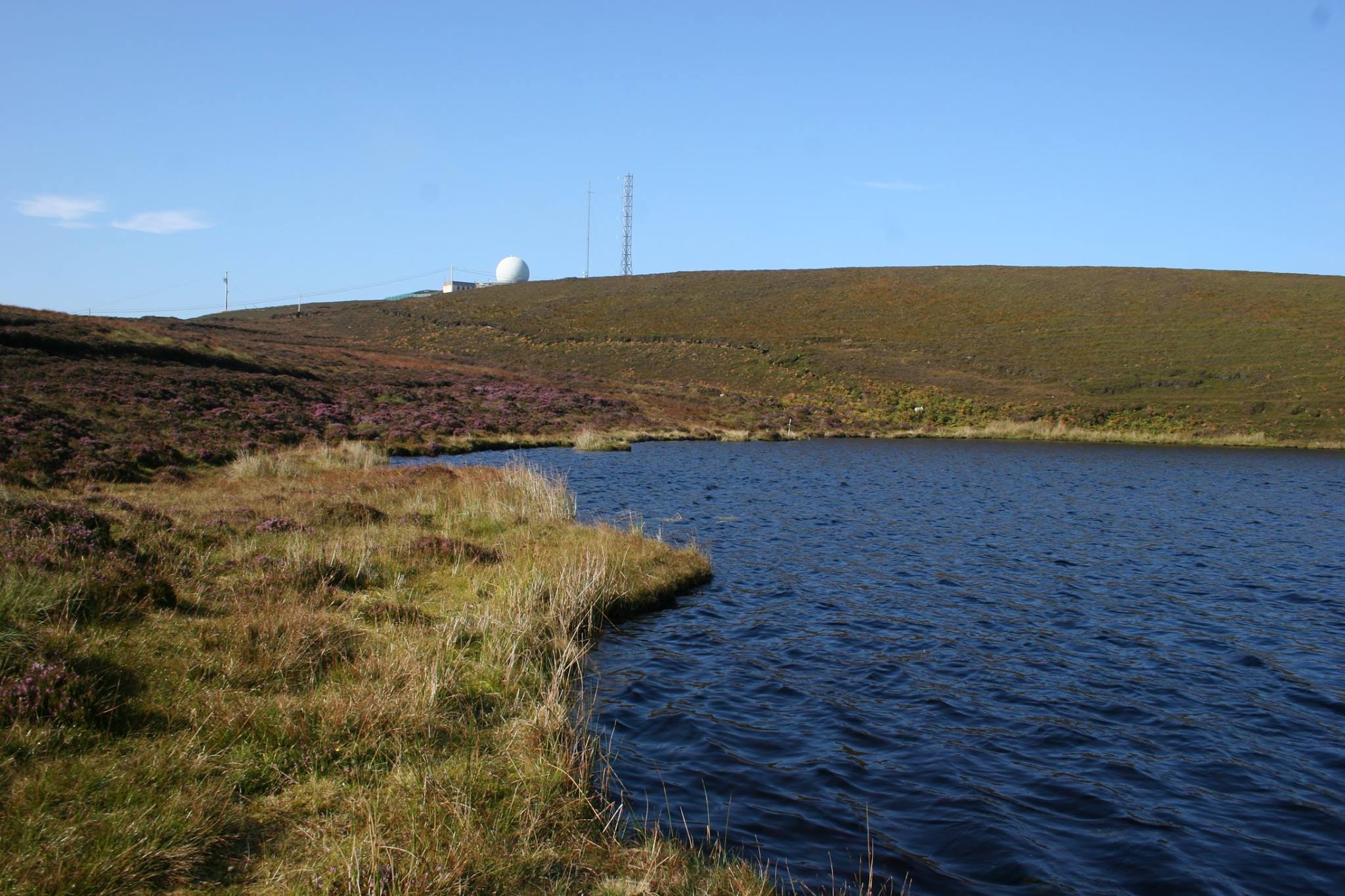
Crocalough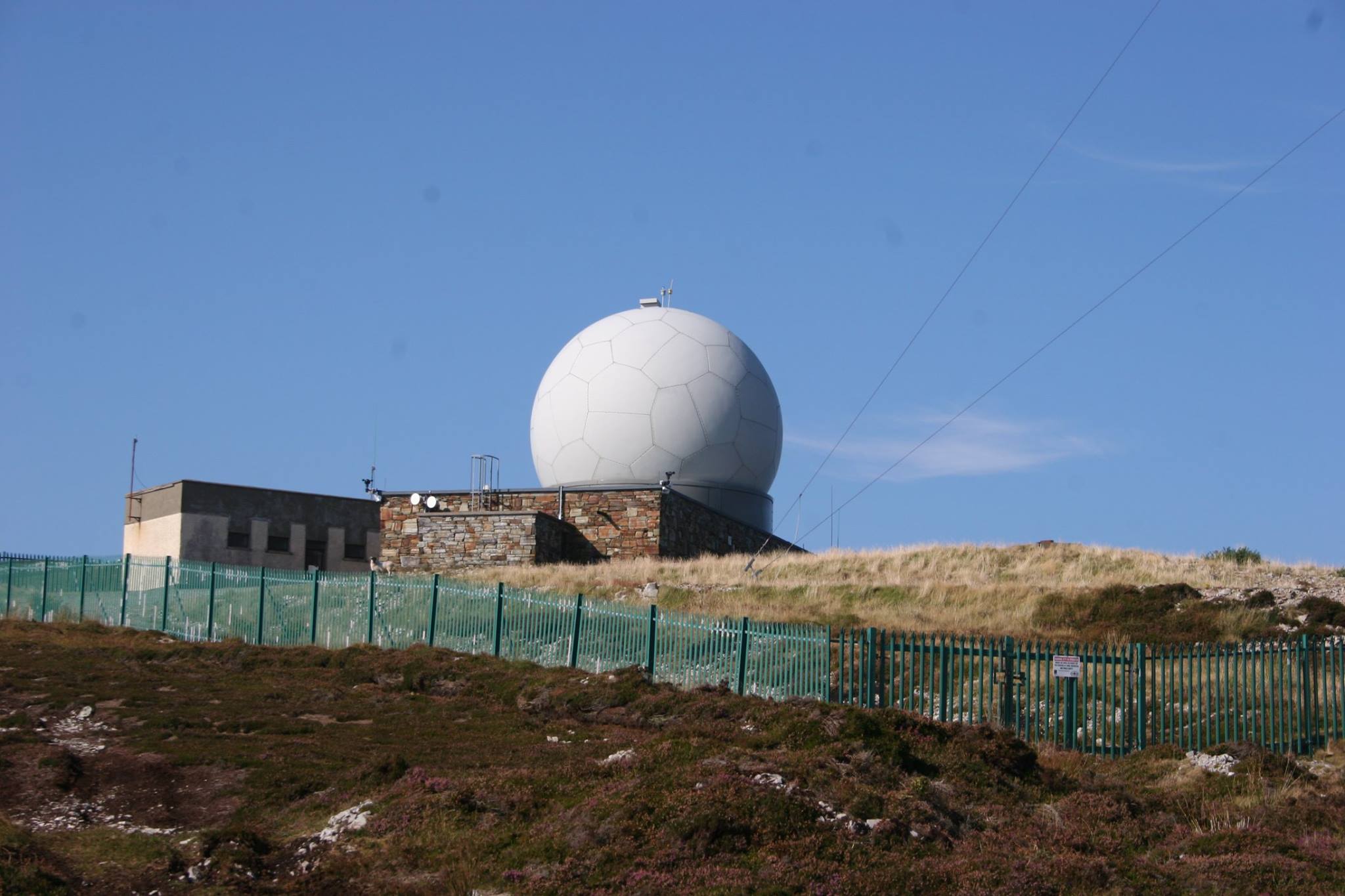
At 282m above sea-level, the Irish Aviation Authority Radar Station, which resembles a large Golf Ball, is a very visible landmark in Malin Head. While a restricted access zone exists around the installation for security reasons, the hill itself is accessible and worth a visit for the splendid views alone. 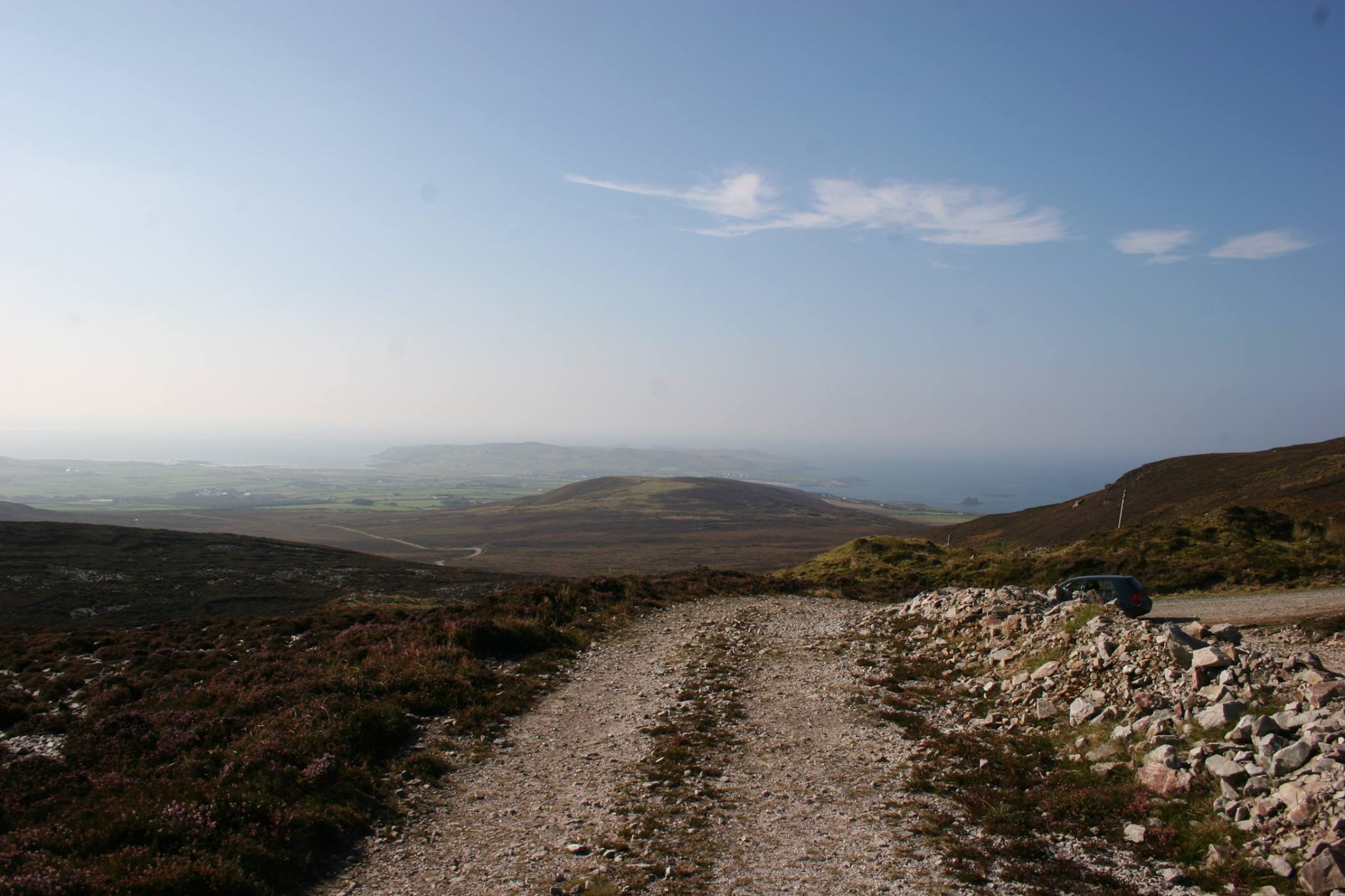
Just south of the ‘Golf Ball’ lies Crocalough lake. There are many local tales and folklore regarding its creation and depth and in the last century it had become a place of pilgrimage where school children were encouraged to circle the lake while reciting prayers.
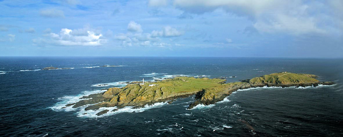
Inishtrahull (Visible from Seaview Viewpoint)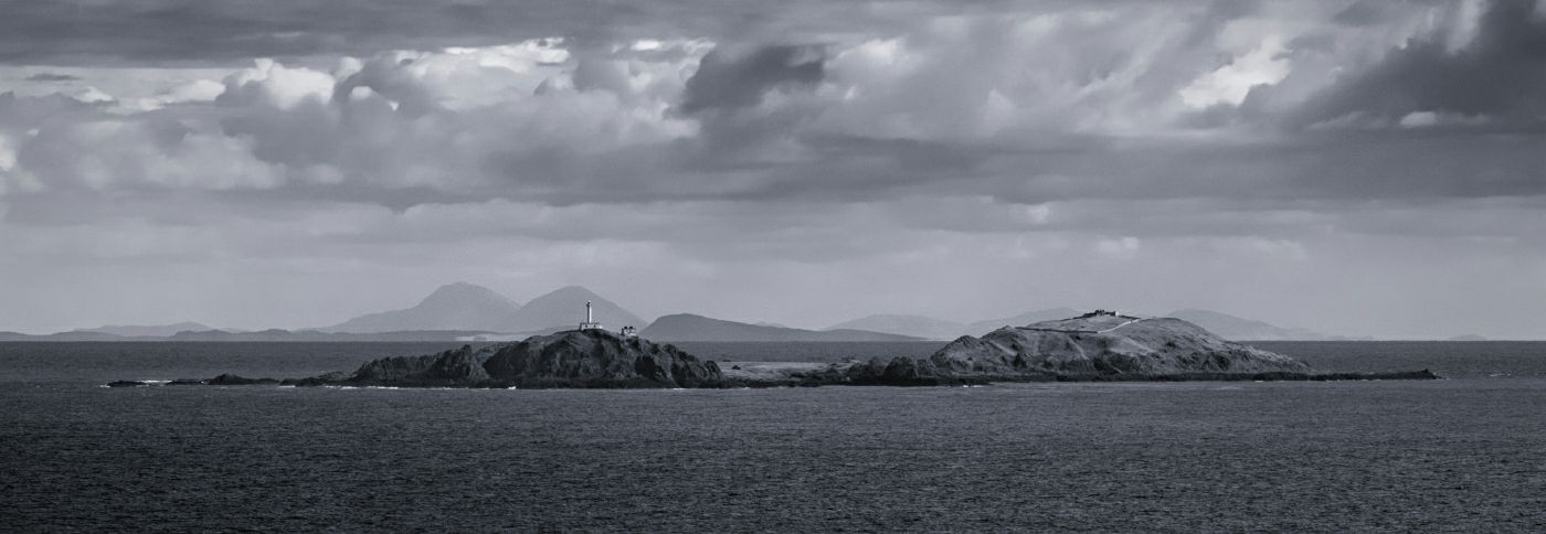
Located 5 miles off-shore, this mile long, hour-glass shaped island has a distinctive profile with its proud lighthouse standing on its western peak. The oldest rocks in Ireland (approximately 1,780 million years old) can be found here in the form of a small outcrop. As the northernmost landmass of Ireland this island is blessed with wildlife rarely seen anywhere else in the country. The island has been uninhabited since 1928 and has been designated a National Nature Reserve.
Knockamany
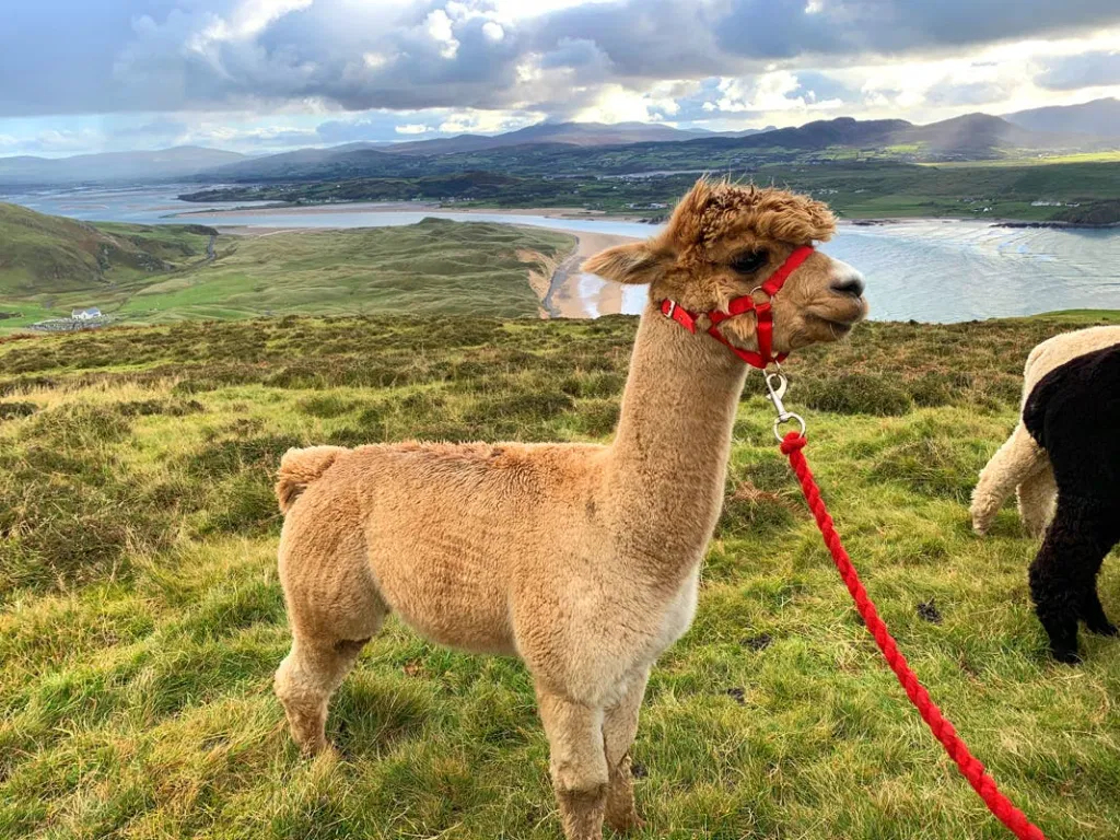
This scenic drive forms part of the long established Inishowen 100 tourist route. It was deemed unsuitable for the Wild Atlantic Way due to its narrow hairpin bends and steep inclines. From the view point you can enjoy breath-taking vistas over Five Fingers Strand, to Glashedy Island, the Isle of Doagh and beyond. A walking tour of this area with an Alpaca is available if it tickles your fancy.
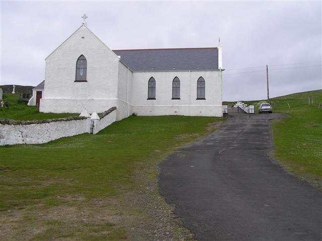
Lagg Church
Tucked in beyond the dunes at Lagg, and built in 1784, St. Mary’s is one of the oldest Catholic churches still in use in Ireland today and was the first to be built in Inishowen following the relaxation of the Penal Laws. It has a simple T-plan with a north south orientation. There are ruins to the west which may be the remains of an earlier church and there are some early eighteenth century grave-markers, one dating to 1719.
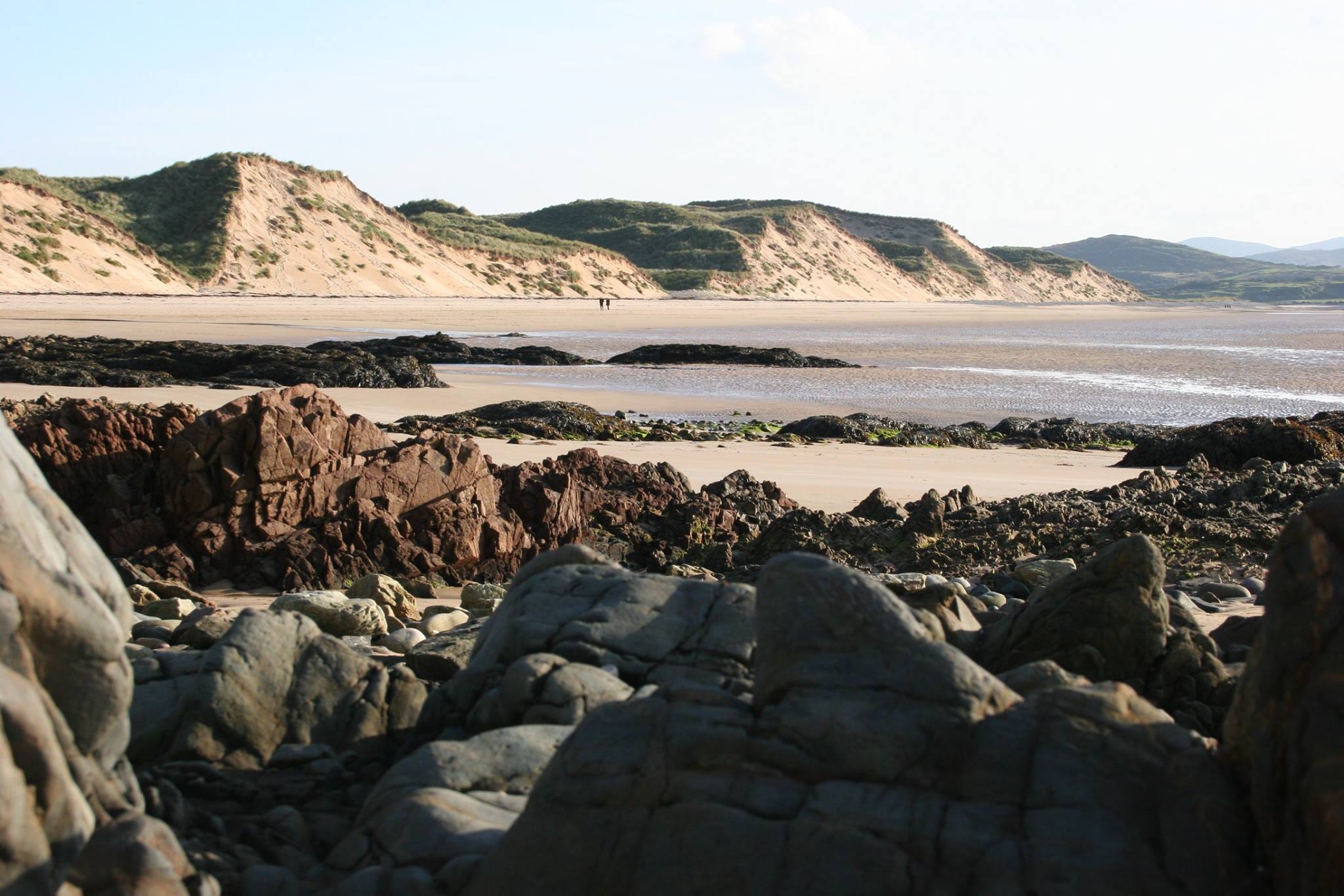
Five Fingers
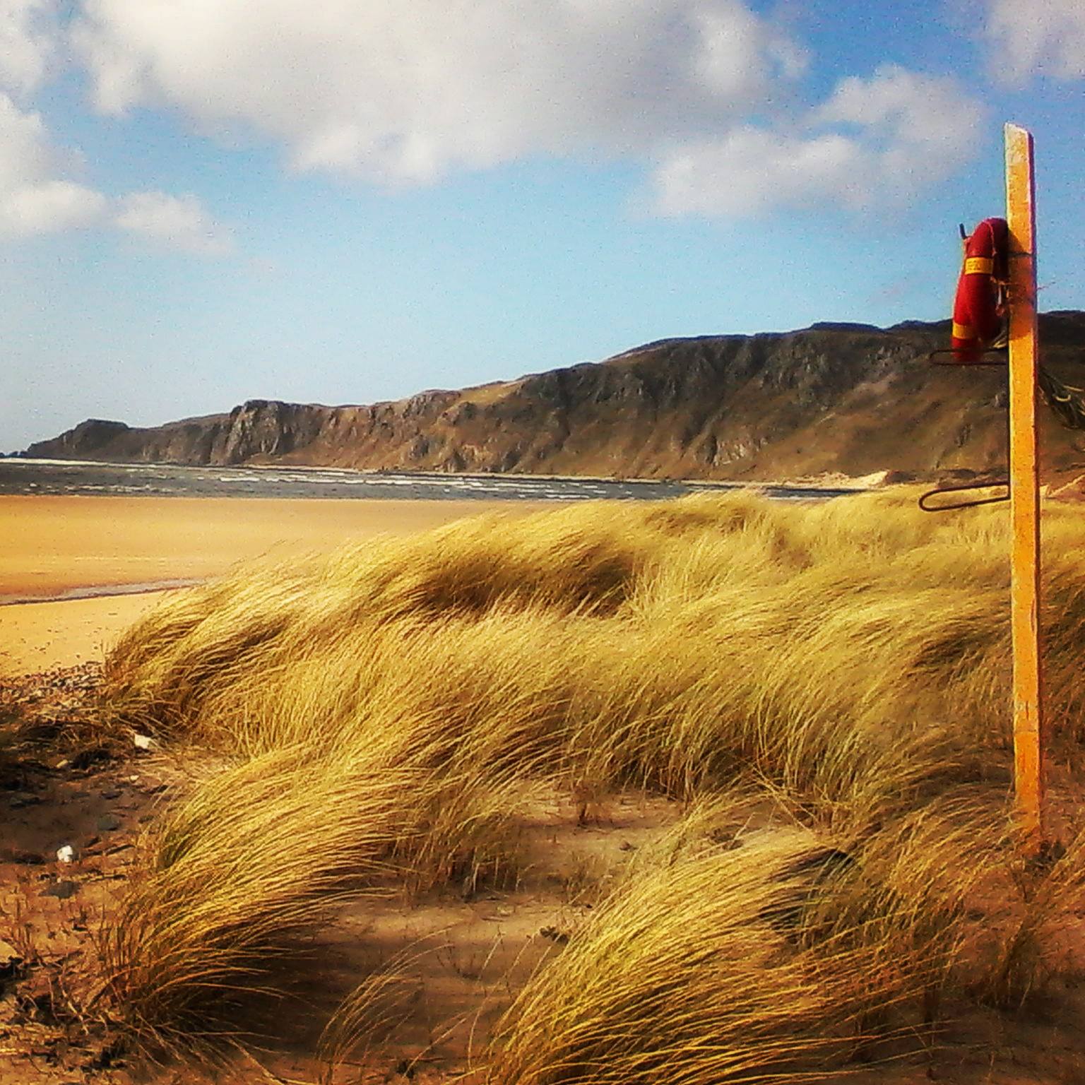
Five Finger Strand is nestled between the sheer cliffs of Knockamany and some of Europe’s largest sand dunes. The name is derived from a rock formation north west of the beach which is clearly visible from the shore. The beach is impassable at high tide but at low tide you can enjoy all the sound and spectacle of the huge Atlantic surf from the safely of the rich golden sand. You may even spot the wreckage of the ‘Twilight’, which sank in 1889.(Note: swimming is strictly prohibited)
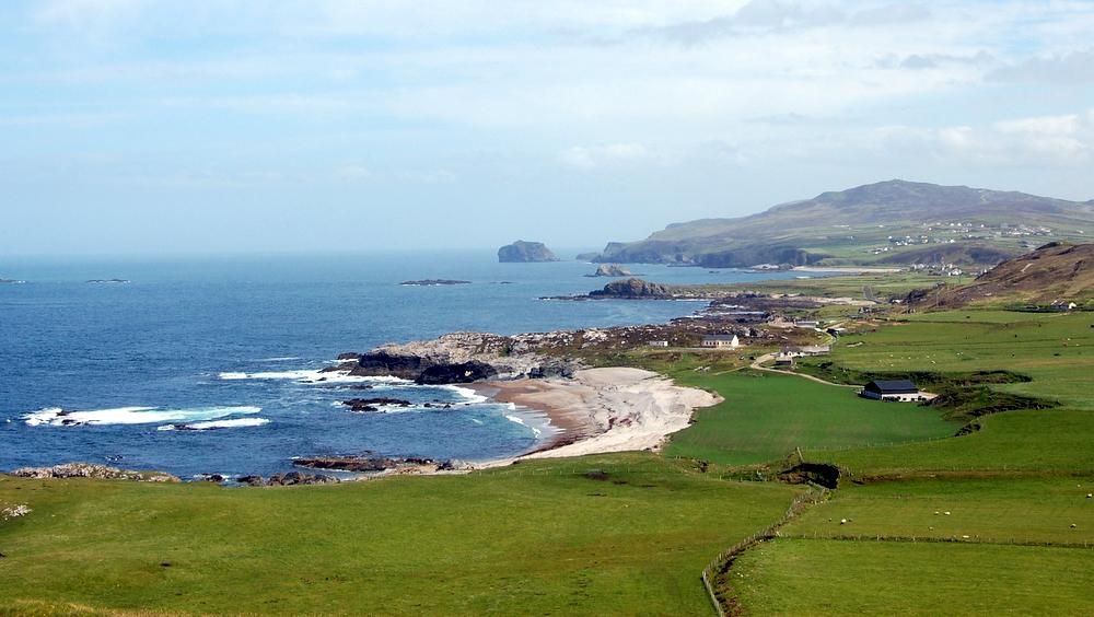
Trawbreaga Bay
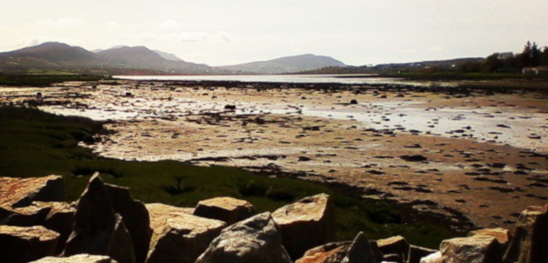
The name Trawbreaga comes from the Irish Tráig Bréige meaning “false strand”. This wetland area extends from Malin Town to meet the sea at Five Fingers. The area floods with the rising tide creating a unique habitat for wildlife and wetland birds such as the Barnacle Goose, Light-bellied Brent Goose and Chough.